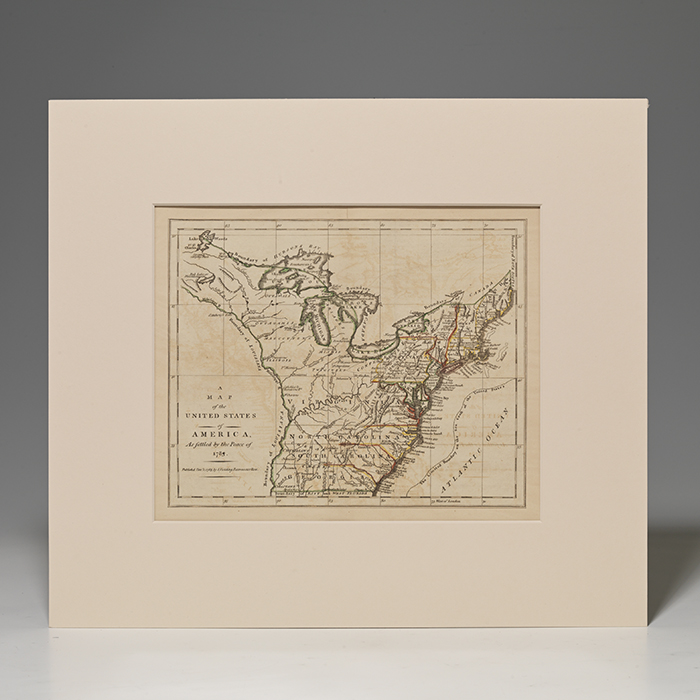
1795 FOLDING MAP OF AMERICA AFTER THE TREATY OF PARIS, WITH LOVELY HAND-COLORED OUTLINES
FIELDING, L. Map of the United States of America, As Settled by the Peace of 1783. London: L. Fielding, 1785. Hand-outlined map, measuring 13-1/2 by 11 inches, window matted. $900.
Important 1785 folding map of America directly after the Treaty of Paris, depicting America from the Florida border to Maine to the Great Lakes, with bright hand-colored outlines.
Originally published just after the end of the Revolutionary War, this map shows America as it emerged from the 1783 Treaty of Paris. With boundaries stretching from the Atlantic to the Mississippi, this map shows the potential—already partially realized—for America to become a global power. Without "European Magazine" in top margin, as present in the 1783 first edition. The map was subsequently published in 1785 in Andrews' History of the War with America, France, Spain, and Holland.
Slight offsetting, original folding creases, evidence of linen book-mounting to verso. Near-fine condition.